Monday, April 30, 2007

Eagle Creek Paddle

On Sunday I a section of Eagle Creek about 30 minutes from Saskatoon. (Zoom out to see where it is in relation to Saskatoon, zoom in to see how twisty the creek is.)


I had heard about it but had never been there. It was a fun day. I dropped my bike off at the end of the section and left the car at the start.


The kayak and bike on top of the Prius ruin the aerodynamic fuel efficiency!

Some sections were very placid:


Other sections were rougher.


The kayak gained a few new scratches on the bottom on these sections. A couple of times I walked down. You could see the creek had been quite a bit higher earlier in the spring.

I saw quite a lot of wildlife including rabbits, deer, muskrats, mink, leopard frogs, geese, ducks, herons, kingfishers, and hawks.


Things are just starting to turn green. The color of the new leaves on the trees is shockingly bright against the drab winter browns and grays.

It was about 10 km as the crow flies but a lot more on the creek. It took me just over four hours. Since it was my first long paddle of the season, I'm sure I'll be a little sore! The day started out sunny and calm but by the time I was biking back to the car it was cloudy, a few drops of rain, and a strong wind (against me, of course!). With the wind and the soft gravel it took me almost an hour to bike the 15 km back to the car.

Wednesday, April 25, 2007

Custom Google Maps

Google Maps recently added the ability to put points and routes onto Google Maps and save the results. It's really easy to use. You can even attach photos or videos. (Note: you'll need a Google account, if you use Gmail you already have one, if not, it's free and easy to register.)

For example, here's one of my regular running routes:

Saskatoon Running Route

Of course, it can be used for a lot of other things - check out some of their featured maps.

Tuesday, April 24, 2007

Signs of Spring

One of the blogs I read has been posting photos of spring flowers (he's in Vancouver). Here in Saskatchewan spring is not as far advanced, but there are signs. The crocuses are also out but I haven't had a chance to photograph them yet. And the pelicans are back, which is always a good sign of spring.


BTW I used a trial version of the new Adobe Lightroom to handle these photos. (On my Mac, but it's also available for Windows) I think I may buy it - it's pretty slick.

Monday, April 23, 2007

2007 Navigation Marathon

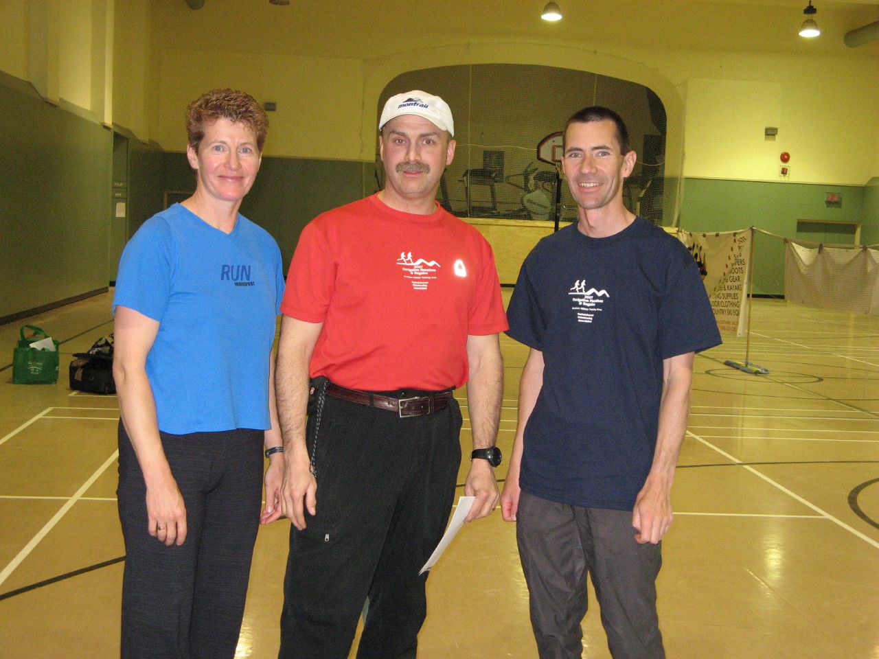
This weekend was the 2007 Navigation Marathon. This is quite a unique event, somewhat patterned after the Original Mountain Marathon. There are three sections: five hours Saturday afternoon, two hours Saturday night in the dark, and four hours Sunday morning. Saturday night you camp out on the course, which means you must carry your camping gear on the course (except for the night section). The event takes place on the Dundurn military training area. In the past the event has been sponsored by the Saskatchewan section of the Alpine Club but it is now run by the new Saskatchewan Orienteering Association.

At the start of each section you get a map with a bunch of locations marked on it. The locations are worth between 10 and 50 points depending on how hard they will be to find, and how far away they are. The goal is to collect the maximum number of points in a fixed amount of time. If you're over on the time you're penalized 2 points per minute. To win you need to move fast over rough terrain, navigate accurately, and optimize your route. It's tricky to decide which points to go after because you're never sure how long it'll take to find the points. If your planning is too optimistic you're liable to come in late and get a big penalty. But if you're too conservative, then you end up not getting as many points as you could have.

The first five hour section went pretty well and we ended up in fifth place. We thought we made pretty good time, covering more than 30 km, and not wasting much time finding markers. But the top teams got significantly more points - they must have been moving a lot faster than we were! We overestimated a little bit on our route and ended up with 40 minutes to cover the last 5 km - a piece of cake if you're out for a jog, but not so easy over rough ground after being on the go for four hours! I was really struggling at this point - Shelley was in better shape because she'd been training for a marathon, but I hadn't been training as much as I should. We made it with seconds to spare. Unfortunately, we had to skip a few close points because of the time limit. But that's part of the game - you want to plan your route so you've got some options at the end depending on whether you're ahead or behind on time.

In the past, our weak point has been the night time navigation so this year we were determined to be extra careful. Between the dark and being careful we felt like we were moving quite a bit slower, but we ended up in fourth on this section - a big improvement over our past night time performance. At the end we decided to go after a close 20 points even though we figured it would put us over slightly on time. Unfortunately, we had a little trouble finding it, so we ended up 11 minutes late resulting in a 22 point penalty. In hindsight we should have skipped it. Of course if we had skipped it we probably would have been kicking ourselves for not going for it!

Sunday morning started off well but then Shelley started to feel sick and we pretty much walked the last three hours. On the positive side, our navigation went really well. We had the first start time but before we even found the first marker another team passed us at high speed. Near the second marker we were surprised to see them running back toward us - they must have run right by the marker. The funny part was that we continued to play leapfrog with them for a couple more hours. They would zoom past us and then we'd catch them at the next marker when they had trouble finding it. We were lucky to find each one right away. At the end of the race they commented that we made their navigation look bad. But they ended up winning the race overall, so their speed must have more than made up for any navigation problems. Considering how slowly we felt we were moving, we were quite surprised to end up in third place on this section. And even more surprised that it was our speed that made the difference because four other teams got the same number of points. I guess everyone else was slowing down by this point as well.

We were pretty happy to end up in third place overall (first place in the co-ed category since the first place team were both male and the second place team were both female). There was some tough competition from Alberta teams this year.

Overall it was a great event as it has been in the past. Mark Rosin and his helpers do a fantastic job of organizing and running it and Kevin Ansdell did a great job of planning the course this year.


Pictures from Warren Long, one of the participants.

Gear

Packing light is an important factor. A light pack won't make you win, but a heavy pack will certainly ruin your chances. Shelley and I have managed to lighten our packs each year. This year they weighed about 7 kg (about 15.5 lbs). This is pretty good considering you are required to carry rain jacket and pants, tent (not just tarp), sleeping bags, stove, food, and water. 2 liters of water was 2 kg (4.4 lbs) of that weight. Most teams were a lot heavier. One team beat us by a few pounds but sacrificed comfort - a one man tent and no thermarests.

For the gear heads reading this, we used a Black Diamond First Light tent (1.2 kg), North Face Kilo Bag sleeping bags (1 kg), Prolite 3 small Therm-a-Rest's (370 g), Arcteryx Alpha SL Goretex jackets (350 g), and an MSR Pocket Rocket stove with Titan titanium pot and a half size fuel cartridge (300 g total). Shelley used Salomon XA Pro 3D trail running shoes. I used the XCR Goretex version of the same shoes, not so much for being waterproof (conditions were pretty dry) but more to keep out the sand which can be pretty abrasive on your feet. We also used short gaitors to keep junk out of our shoes.

Friday, April 13, 2007

Sunday, March 11, 2007

Spring Arrives

Daytime temperatures are rising above freezing, the snow is beginning to melt, the days are gradually getting longer - spring is coming to Saskatchewan. We have such radically different seasons here. The year has a very definite cycle. People from other countries often know about our cold, snowy winters, but they are often very surprised to hear about our hot summers (up to 40 C or 100 F).

Of course, it's a messy time of year as the winter's accumulation of snow and ice melt. I was glad of the studded tires on my bike this morning as I was riding over yesterday's melt water that had frozen overnight. It's hard on the bike as well - it gets plastered with mud and sand. I hate the sound of my chain full of grit. But it's pretty much impossible to keep clean. Once the streets are clear I usually end up buying a new chain after the abuse of winter.

Even the Canada geese are returning - I saw the first few yesterday. They are such funny birds - honking away all the time. They are a good sign of spring. The only sad part is that my mother is not here to see them. In the last few years when she was increasingly limited, she could still see and hear them on the river from her apartment. I know she would have been happy to have them back once more.

Monday, February 26, 2007

Sunday, February 04, 2007

Assorted Minor Adventures

I've fallen way behind on writing about my adventures. Not that they have been big adventures, more travel than adventure really.

In the fall Shelley and I made our annual pilgrimage to the Banff Mountain Book and Film Festivals. (Check out the intro on YouTube.) We always enjoy the book festival more because it's smaller and has more live speakers and panels, but the films were good too.

A week and a half later we went to Las Vegas for a week. We thought it would be cool to stay on the strip and climb at Red Rocks, especially since I hadn't seen Vegas for 20 years. It turned out to be a poor idea. The strip is just not our cup of tea. Too many people, too much of everything I don't like about humanity. But we did enjoy a couple of Cirque de Soleil shows and some good dinners out. The other downside is driving in and out of Vegas to go climbing each day. It's not far but it takes a while through the traffic. I'd be more inclined to camp but the campground is pretty bleak. The climbing was great, although both times we did longer multi-pitch climbs we got stuck behind slow beginners which was a bit frustrating, especially since overall it wasn't that busy. But we were picking moderate routes which I guess explains the traffic.

A week and a half later we went to the Florida Keys for 10 days. We flew in and out of Miami but didn't spend any time there. My first impression was that the Keys were just one giant strip mall. But once you get off the highway it's great. We took a boat to the Dry Tortugas and camped overnight there, explored the fort and snorkeled off the beach. Luckily we avoided contact with the Portugese Man o' War which were abundant. They can give a nasty sting. Conditions weren't ideal (too windy) but I did get out for a couple of dives one day at John Pennekamp Coral Reef State Park. I tried out my new waterproof housing for my camera. The only problem was that I accidentally switched it into movie mode so every time I clicked the shutter it would start/stop recording, which of course filled up the memory card. So I didn't get as many good shots as I would have liked. Shelley came along and snorkeled a bit on her own around the boat. Pretty good considering she's nervous about it in the first place and it was quite rough.

And then we spent Christmas with my sisters in Tofino on the west coast of Vancouver Island. Considering the time of year we were pretty lucky with the weather. One big storm (which is one of the attractions) but also a few nice and amazingly dry (no rain) days. We got out sea kayaking for a few hours which was great. I'd love to do more sea kayaking on the west coast. But the really brave people were the ones out surfing in the sub-zero weather (snow on the beach!)

After those trips in quick succession we've had a bit of a lull. But I'm going to a conference (Etech) in San Diego at the end of March so we're going to go down for a week or so before the conference, rent a car, and drive down into Baja. Maybe another chance for some sea kayaking and diving or snorkeling. :-)

Sadly, all these trips were shadowed by my mother, Pauline McKinlay, dying in the fall. She was 80 years old and had a good full life, and she went peacefully in her sleep the way she wanted. But that didn't make it any easier. We had been good friends. In many ways she was my inspiration for leading an adventurous life. Not that she was a climber or adventurer in the conventional sense, but she nonetheless had many adventures - leaving England to go to East Africa with my father for ten years on a "whim" and then leaving there to settle in Saskatchewan - a place they knew nothing about and that was about as opposite from colonial East Africa as you could get, both climate wise and culturally. And she had the right attitude for an adventurer, no matter how tough things got, right up to the end, she always managed a smile. I miss her dearly.

Saturday, January 13, 2007

Blizzard

We had a huge blizzard last week - the worst in 50 years apparently. Roads were closed and cars were stuck and abandoned everywhere. The funny part was, for me, on foot, it was no big deal. I walked to work in the morning, walked home at the end of the day. It was snowing and pretty windy, and there were some big snow drifts, but compared to trying to drive anywhere it was a walk in the park. Of course, you wanted to be dressed for the weather, but that goes without saying if you walk to work.

Here's a few photos I took around the office a few days after the storm:

2007JanuarySaskatoonBlizzard

Wednesday, November 08, 2006

Smallest Adventures

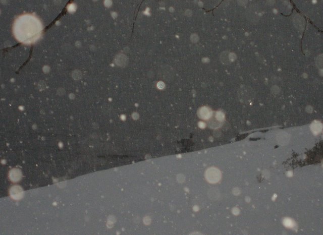
I woke up to fresh snow this morning and it was still falling thickly as I walked to work.


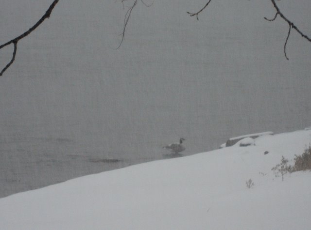
There are still a few Canada geese around but they looked a little sad with the snow on their backs.


I'm lucky that my walk to work is along the river. It's nice to experience a little nature before spending the day in the office.


These pictures were taken with a new Canon SD700 IS.

Wednesday, October 18, 2006

Bike Update

In the end I didn't have to buy a new bike. My bike store (Bike Doctor) managed to get me a new frame from Cannondale at a reasonable price. My blue bike is gone - I now have a shiny black one.

The only nit to pick is that it's an F400 frame, one model down from the F600 I started with. This also means it has mounts for V brakes which I don't need since the F600 has disc brakes. No big deal.

So I'm happily back on the road. Or I would be happy if it hadn't just snowed leaving everything icy :-( The joys of living in Saskatchewan!

Downriver

Last weekend I paddled my new kayak down the river (the South Saskatchewan that runs through Saskatoon). I had originally planned to leave Saturday but the rain never quit so I postponed to Sunday. (Monday was a holiday here.)

I bought the kayak about a month ago. It was a little crazy to buy a kayak at the end of the season, but I got out in it quite a few times and it'll be ready for the spring. It's a yellow and white Evergreen Envy. Previously, all I had was an inflatable Sea Eagle, so it was quite a step up. I love the feeling of the kayak becoming part of me, like riding a bike. Not having to think about the mechanics, just moving freely and easily.

I started at the Clarkboro Ferry (west of Warmen) about 20 km downriver from Saskatoon since I'd previously paddled that far. I wasn't sure how far I'd get in two days. I ended up making it to Batoche (northwest of Rosthern), about 60 km down the river. Needless to say, I would never have made it that far if I hadn't had the current with me. Paddled about 7 hours each day with occasional breaks to stretch my legs.

The weather was pretty good but cool - only about 5 C (40 F) when I left. A bit of a rain storm Sunday afternoon but only for about 30 min. A huge luminous yellow moon rose over the river at sunset painting a gold streak of reflection down the river. The night was cold, heavy frost and ice in my water bag. I'd set up camp where I'd get the morning sun but there's not much warmth in it this time of year. Not like the powerful sun at altitude in the himalaya. The wind was stronger on Monday but luckily it was mostly behind me.

It would have been nice to go a week or two earlier before the leaves fell. It was a little bleak with the bare trees. But maybe it suited my mood. My mother had died a week before and this trip was my first chance to get away after six weeks hanging around the hospital. We had been close - talking on the phone every day and getting together several times a week. It was a trip she would have loved (not that she had been capable of it for quite a few years). She loved the outdoors, nature, animals, plants. But the adventure of life has its end like everything else.

I saw some wildlife along the way - great blue herons, bald eagles, mule deer, muskrats, and of course flocks of canada geese, ducks, and gulls heading south. Lots of signs of beaver but I didn't see any.

Batoche was a good spot to pull out - it was only a short way on a good path from the river to the parking lot. I called Shelley on the cell phone to come get me. Unfortunately, the gate was locked so we had to carry the kayak and my gear 2 km to the highway.

It was a good trip. There are farms and houses all along the river. But no one else was on the river so I had solitude if not wilderness.

Sunday, August 06, 2006

Bicycle Blues

I came out of the office yesterday afternoon to find that someone had tried to steal my bike. It was locked up with a U-lock through the frame. They bent the U-lock but it still held. However, in the process they damaged the frame badly. Surprisingly, they didn't trash the bike - everything else seemed ok. I could even ride it home.

It's quite a sickening feeling when something like this happens. It's just a bike, and I have insurance, and it can be replaced, but it still hurts. You get quite attached to things like bicycles. It's almost like they're an extension of your body, part of you. Maybe some people feel that way about their cars, but to me a car is a lot less "personal".

I'm assuming it won't be worthwhile to replace the frame. Maybe I can get something for the wheels and components - they're in pretty good shape.

This bike was a Cannondale F600. Before that I had an M400. I wonder what I should buy this time? I was happy with the F600, or I could move up to an F800 or F1000 (although I'd have to get use to the Lefty shock!) Or should I be going to full suspension, like a Scalpel? And that's just staying with a Cannondale. I'm used to them, but there's lots of other good bikes out there.

Normally, buying a new bike is exciting, but being forced to do it like this takes some of the pleasure out of it.

Saturday, July 15, 2006

GPS to Google Earth

I'm a big fan of Google Earth (and Google Maps, especially the Hybrid view). If you upgrade to Google Earth Plus ($20 per year) you can interface to GPS devices. I picked up a data cable and tried it out. It's a little slow getting the information from the GPS but it works pretty slick. I still had Cho Oyu data on my GPS (a Garmin Geko 301) so I downloaded that first. Next was the data from the Willingdon trip. Most recently I downloaded the data from a canoe trip down the river. Very cool.

For topo maps I use Fugawi. They also have software that'll talk to a GPS but I haven't tried it yet.

Saturday, July 08, 2006

Climbing Mt. Willingdon

Last weekend Shelley and I headed out to the mountains. It was a holiday long weekend so we picked a destination to escape the crowds. We had seen Mt. Willingdon in The 11000ers of the Canadian Rockies by Bill Corbett. It looked remote enough to not be crowded. Of course the highways getting there were busy (but we were enjoying our brand new Toyota Prius hybrid so it wasn't too bad).

We drove out Friday (stopping at MEC to spend money) and camped at Lake Louise so we could buy backcountry passes in the morning at the information center (and have breakfast at Laggans first!) Then we drove up to Mosquito Creek where we left the car in the hostel parking lot. (It made us a little nervous to leave our brand new car in a lot that had a lot of broken auto glass on the ground! We worried about this all weekend, but in the end the car was fine.)

We started hiking in at 10am - not exactly an alpine start, but the book said 6 to 8 hours to hike in so we still had plenty of time. The first part of the approach follows the Mosquito Creek trail, leaving it at the bridge where the north branch of the creek comes in. After that there's no real trail, although there are various faint paths. It's fairly straightforward to follow the shore of the creek. We ended up taking our boots off twice to cross the creek where the shore got impassable. After a few kilometers along the creek you angle up to the right through openings in the trees to a big grassy amphitheater with Quartz Pass above. Getting up to the pass requires varying amounts of steep boulder hopping, depending how well you pick your route.

The view down the East side of the pass is a little intimidating. The book said to be sure to "scope out the route". The question was where the route went. We explored a bit but decided to down pretty much directly from the low point of the pass where there's a narrow steep snow gully. We traversed out and back on the rock to avoid the steepest part of the snow, but the rock was loose and ugly - a bit nerve wracking with the long potential fall. Once on the snow we kicked steps down the steepest part and then glissaded the rest. Meanwhile two young guys also heading to Willingdon had come down a little further south and passed us - their route looked a lot better.

The final slog across to Devon Lakes was hot and tiring. We arrived about 5pm for a time of 7 hours - right in the guidebook estimate of 6 to 8. We had brought our new Black Diamond First Light tent - only about 1kg, our North Face Kilobags, and Prolite 3 Short thermarests. It's sure nice having this light gear to keep the pack weight down. Ice axes and crampons added a bit, but at least we didn't have to carry a rope and rack. Helmets would have been nice in a few spots.

Although the book said only 6 hours for the climb, we decided to get an early start (5am) to avoid the heat and soft snow. (And because we hoped to get a head start on the hike out that same day.) The climb is pretty straightforward. Parts of the ridge looked a little scary from below but turned out to be easy scrambling. We avoided the snow until just below the cliff band that forms the final obstacle. It was icy so we put on our crampons for this bit. The cliff isn't that high - only a body length or two - but it was early enough when we got there that the rock was covered in a thin layer of ice from yesterday's melt water. We found one spot that seemed dry and had good holds. The only problem was pulling over the lip where it was loose rock and scree slippery with ice. From there it was an easy scree slope to the top which we reached at 10am (four hours up). It was a beautiful sunny day with fantastic views all around.

Neither of us wanted to go back down the cliff band so we went over the top looking for the alternative descent described in a typical vague fashion. We ended up descending the snow gully just on the other side of the summit. It was mostly easy step kicking with a few icy parts to keep things interesting. The gully led us out onto the South "face". From below this looks very steep, but it's mostly scree with a few rock bands. Unfortunately, one larger cliff band prevents you from descending straight down so we traversed across the face to a gully beside the ascent ridge. From there it was an easy walk back to camp by about 12:00

After a break we packed up and moved camp to the foot of Quartz Pass. Shelley suggested we could go over the pass that day, but it was hot and we'd already had a long day. We watched another party go up that afternoon. When we talked to them the next day they confirmed our decision saying it had been extremely hot and the snow extremely soft. It was hot enough for us hanging out by the tent! The mosquitoes were bad enough that you'd rather not be outside but on the other hand it was too hot inside the tent.

The next day we slept through our watch alarms but still got away by 7am. Starting fresh, in the cool of the morning, it was an easy climb up and over the pass (taking the better route we'd seen the other pair take). Rather than going straight down to the creek we traversed the hillside diagonally, avoiding the awkward spots where we'd had to cross the creek. We joined the creek where a wide waterfall comes in from the West. Hiking back down the creek seemed to take forever but we eventually hit the bridge and rejoined the main path for an easy hike down to the road and the car.

We got down about noon, stopped in Lake Louise for a shower and lunch at the Alpine Club / Youth Hostel center, and drove the tedious 7 or 8 hours back to Saskatoon.

All in all a great weekend! Photos

Tuesday, June 20, 2006

More on Cho Oyu

I should have written this as soon as I got back, but things have been busy, as always. Lots of memories from the trip (even though it already seems like I was never gone!) Here's how it went...

43 hours after leaving Saskatoon I arrived safely in Kathmandu with my luggage intact. Hurdle number one passed.

I wasn't as excited about Kathmandu this time. It's still a neat place and I enjoyed revisiting favorite spots, but I wasn't as excited about being there as I have been in the past. The political turmoil didn't help - soldiers and police everywhere, tanks rolling down the streets, curfew keeping us shut in the hotel. In the Thamel tourist district, where our hotel was, it was pretty quiet and there were few signs of the problems. But from the rooftop terrace of our hotel we could hear teargas and gunfire and see the pillars of smoke from demonstrators burning tires in the streets.

Because of the problems we were delayed a day and ended up taking a helicopter from Kathmandu to Kodari on the border with Tibet. It cost us an extra $300 each but I think it was worth it. We were glad to "escape" from Kathmandu.

Although I was climbing solo I traveled and shared a base camp with 7 other climbers (one pair and 6 more solo) who had also signed up with Asian Trekking.

We skipped the night at Zhangmu and went straight to Nyalam, putting us back on schedule. Two nights there, then on to Tingri for another two nights of acclimatization. Neither place is any joy. Cold, windy, dirty. The same chinese food every day. On the positive side, it makes you happy to get to basecamp!

A little headache and nausea at Nyalam but not too bad. Maybe altitude or maybe just the food or water. Several of our group were hit quite badly by traveler's diarhea and vomiting.

The end of the road (Chinese Base Camp) was as desolate, windy, and dusty as I remembered. The difference was the Tibetan teahouses where you could eat and sleep (for a price). Nothing like that last time I was here.

Another difference was the road all the way to the intermediate camp. For $50 four of hired a jeep to drive us up. I felt a little guilty not walking, but there didn't seem much point in walking up the road!

We had only planned to stay overnight at the intermediate camp (more Tibetan teahouses!) but that night it started to snow and continued for two days. Even when it stopped we couldn't continue because the snow was too soft and deep for the yaks. We ended up staying four nights.

I felt great the day we hiked up to advanced base camp (the real basecamp). We were one of the last groups to leave, but I steadily passed people until just before ABC I caught up with the trail breaking crew (two Tibetans with shovels plus four yaks with no loads).

To be honest, I got a bit pessimistic. From the start, nothing really went the way I wanted! On the way in I didn't acclimatize as well as I would have liked. Part of the problem was the usual stomach problems. I had one miserable time at Base Camp where I spent the night spewing from both ends at once. Not something I'd recommend to anyone, but not unusual on these kind of trips. A cocktail of Immodium (for diarrhea), Cipro (antibiotic), and Stematil (for nausea) eventually settled me down. Then the first time I tried to carry a load to Camp 1, I didn't make it (too tired). Then when I tried to carry to Camp 2, I also didn't make it (too slow). When I was planning to go to sleep at Camp 2 (and make an acclimatization climb to Camp 3) the weather turned bad and I had to go down. Meanwhile, most of the others seemed to be doing a lot better. Needless to say it was a little depressing, despite knowing that these expeditions always have their ups and downs.

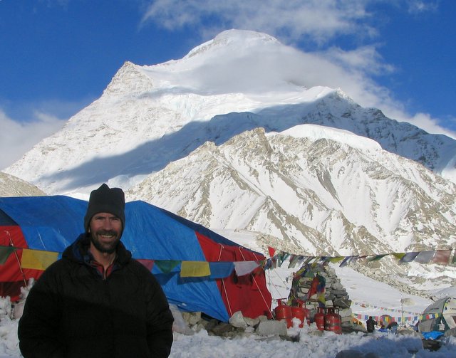
So when I headed up for my summit attempt I was somewhat dubious - I hadn't even slept at Camp 2 let alone visited Camp 3. I headed up the day before everyone else, spent a day at Camp 2 to acclimatize, and then when the weather looked good, headed up from Camp 2 at 2:30am. (I didn't have the time or energy to establish a Camp 3, and I think if you can get away without it, you're better off as it's high enough to be debilitating) It had snowed and blown the day before so I had to break trail from Camp 2 to Camp 3 in the dark. (The funny part is that I broke trail for Fernando, who had oxygen, and his Sherpa!) Despite breaking trail I made Camp 3 in 3 hours. I had timed it so it would get light about the time I got to Camp 3 so I could see where to go. I thought the people in Camp 3 would be leaving for the summit, but for some reason no one in Camp 3 went up that day, despite the great weather. It was a bit windy and of course cold on the way to Camp 3, but after the sun came up the wind died down and it was a beautiful warm day. Again, because of the recent snow and wind there were no tracks to follow so I had a true solo summit day which was rather nice actually. Better than following a line of people up a well trodden path! Fernando and his sherpa took a different route so I didn't see anyone above Camp 3. It's actually quite a steep climb from Camp 3 to the summit plateau. Not hard, but you wouldn't want to slip. Once you reach the summit plateau it's another 1/2 km to the actual summit with only a very gradually rise. At 8100 - 8200m it's a terribly slow slog. Any excuse like weather or time and I'm sure I would have skipped it, but the weather was perfect and I was in good time so I dragged my butt to the real summit where you finally get a view of Everest on the far side of the mountain. Got there at 12 noon, took some pictures of the prayer flags and junk (oxygen bottle) on the summit and then headed down.

I was very conscious about being safe on the way down with the steep ice and loose rock. Finally made it back to Camp 2 at 4 pm. Over the 14 hour "day" I drank only a liter of water (although I carried three) and ate only 4 gels! The next day I packed up my Camp 2 and carried a big load down to Camp 1. Packed up Camp 1 and continued on to ABC. (I have to confess I left a load at Camp 1 for a porter to retrieve.)

Climbing is all about "style", not just getting to the top, but how you do it. This might seem strange, but if you think about it, it makes sense. If all you cared about was getting to the top, you could take a helicopter! I was pleased not only with being successful, but also with the style I did it in. Unlike everyone else in our group (and most other groups), I carried all my own gear up (no porters or sherpas), established my own camps, didn't use other people's tents etc. didn't use oxygen, and went from Camp 2 instead of Camp 3 (longer). Not bad for an old guy! (I turned 46 at Camp 1)

Although the climb isn't "difficult", it's still not something to take lightly. A sad reminder of the risks came a few days later when a German slipped on the way down from the summit and fell to his death.

Monday, June 12, 2006

2006 Urban Adventure Challenge

Saturday (June 10) was the third annual Urban Adventure Challenge - an urban adventure race in Saskatoon. There were only 12 teams this year - I think some people got scared off by the excessive amounts of running in last year's race - 20 km is a lot unless you've trained for it, and this is meant to be a "fun" race. Of course, this year there wasn't much running at all! Instead it rained the whole time, not hard, just a steady drizzle. But it was warm enough when you were moving so it didn't really matter. Better in many ways than being too hot.

As usual it was a fun race. They even managed to include some canoeing for the first time on an artificial lake in one of the suburbs. For fun, we even got to ride the miniature train in Kinsmen park!

We biked about 30 km and I would guess we ran about 10 km in total in the three running legs. I'm not sure how fast the winning teams finished - my team took about three hours for 7th or 8th place. We would have done better but we gambled on a shortcut biking which ended up costing us some time and in a short race like this you don't have much chance to recover from setbacks.

I had Jeff and Suzanne on my team. Jeff and I have raced together lots - including all five of the Prairie Pitches, the last two Urban Challenges. We couldn't get our normal thirds so we asked a friend of Shelley's to join us. It was Suzanne's first adventure race but she just ran a half marathon a few weeks ago so she was in good shape. Probably better than Jeff or I since we hadn't trained much yet this spring. My lungs were probably in good shape from Cho Oyu but I hadn't biked or ran for months.

Now I have to get busy organizing the Prairie Pitch. After five years of racing in it, it will be a change to be on the other side of the fence. Tony, who has organized it up till now, will be racing this year so it'll be a switch for him too. Tony has done a good job of organizing the Prairie Pitch (and the Urban Challenge) - I hope I can match the standard he's set.