Tuesday, July 03, 2007

Grand Cayman Butterflies

Here are a few of the butterfly photos I took in Grand Cayman, mostly at the Butterfly Farm. (Click on them to enlarge.) They're not as skittish as some animals, but they do have a bad habit of sitting still until just when you're ready to shoot and then flitting off. Or they come to rest in a spot impossible to photograph. At least in the Butterfly Farm there's a higher concentration so you get more opportunities.


As with most of my nature photos, these were taken with the Canon S3 IS at full (12x) zoom (except for the one with Shelley in the background). The zoom allows you to keep a little distance and not spook them but still get closeups. One problem is that you don't have a lot of depth of focus and since the focusing is automatic it's tricky getting the camera to focus on what you want. A lot of the shots were a write-off because they were out of focus. That's where a DSLR might be better but it would be hard to match the zoom range and the image stabilization, let alone the price.

Here's me busy at the Butterfly Farm (photo by Shelley).

Monday, July 02, 2007

Tadpoles Grow Legs

I haven't posted any pictures of the tadpoles for a while. Apart from getting bigger and developing more color and shape, they've been fairly static. But they've finally started to grow legs. They went from egg to tadpole so fast that I thought their whole development would be faster but they've stayed in the tadpole stage longer than I expected. (I released several batches of them as they grew and the aquarium got too crowded.)

These aren't great pictures - between lighting, reflections, focus, and moving targets it's tricky. But they suffice to show what's happening.


You can click on the pictures to get a larger view. As you can see, there's quite a lot of variation in size and stage of development, even though they're all from the same batch of eggs.

It's interesting to compare these pictures to the first batch.

Now I'm waiting for the arms to show up :-)

PS. The next day I see one of the tadpoles has arms! Either they emerged overnight, or else that tadpole had been hiding. I'll try for some pictures once a few more of them develop arms. I'm not sure when they transition to breathing air, but I added a ramp so they can get out of the water when they need to.

PPS. What does this have to do with "adventure"? To me, nature is a big and integral part of adventure. And an appreciation and knowledge of nature enhances our adventures.

Friday, June 29, 2007

Sunblock

Outdoor activities often require sunscreen. Here's an interesting evaluation of products:

http://www.cosmeticsdatabase.com/special/sunscreens/summary.php

This was especially relevant to me since I just got back from 10 days snorkeling and diving on Grand Cayman where I was applying sunscreen multiple times a day.

Sunday, June 03, 2007

Nature Paddle on Pike Lake

There were quite a few muskrats around. This fellow actually sat still long enough for me to get a decent picture.


Catching this guy on the move was a little tricky. Most of my shots were out of focus, but this one came out quite well.


Lots of red-winged blackbirds around too.


The water lilies were just starting to flower.


It was a beautiful calm morning.


These shots were all with the Canon S3. I love the 12x zoom and image stabilization for this kind of nature photography.

Monday, May 28, 2007

Free Canadian Digital Topo Maps

Someone just sent me a link to a source of free Canadian digital topographic maps scanned at 300 dpi. (BTW It seems strange that the government has to scan paper versions of maps they printed in the first place. Couldn't they do a more direct conversion?)

You need to know the map id, but you can get that from an online index.

I use Fugawi and Etopo maps and they're more user-friendly, but they are only 150 dpi and they tend to be out of date (and they cost money) In the past sometimes I have ended up getting the paper maps and scanning them myself but maybe now I won't have to.

You can also use the on-line government Toporama, but compared to Google Maps/Earth it is pretty bad.

What I'd really like is if the government would provide free vector versions of the maps. When they announced that they would discontinue printed paper maps they said they would provide free vector maps on-line. But this seems to have gotten lost when there was so much outcry and they decided to continue with paper maps. Personally, I'd rather have the digital ones!

Saturday, May 26, 2007

May long weekend climbing

We had originally planned to go to Skaha, a climbing area near Penticton, but at the last minute the weather forecast changed our minds and we decided to go to the Needles in the Black Hills of South Dakota. Apart from the weather it was a long weekend in Canada, so Skaha would likely be busy, but it wasn't a long weekend in the States.

It's about 1100 km which took us about 12 hours. We left early Wed., but didn't go quite all the way the first day, stopping at Hidden Valley campground just past Deadwood. The campground was open, but we never did find any staff. We ended up slipping our fee under the office door. It was a nice spot. We even had some deer wander by our tent.

The tent, however, was not pretty. When I packed I grabbed the three man tent but the two man poles. Needless to say, that doesn't work too well. That's one of the problems with having collected so much gear!

The next morning we drove the rest of the way to Custer, went for breakfast at the Songbird Cafe, picked up some groceries, and then drove up to Sylvan Lake. The other two times we've been to the Needles we've stayed at the Sylvan Lake campground but we found it closed - it didn't open till the next day. So we ended up staying at Fort WeLikIt Campground just outside Custer. It was nothing special but it was fairly empty and therefore quiet. And the bathrooms and showers were clean with lots of hot water.

The first day we sport climbed (bolted routes) in the "outlets" at the end of Sylvan Lake, starting with a few routes on Youbet Jourasses and then moving over to the west end of Inner Outlet and the north face of Lakeview. Nothing too hard, but it was a good warm up. (For me anyway, since I haven't been climbing since our fall trip to Red Rocks. Shelley has been climbing in the gym.)

The next day we decided to do Diagonal Traverse, a classic three pitch trad route on Outer Outlet. It's rated 5.6 but it seems a lot harder. We've done it before - it's a fun climb. It follows a crack/flake that cuts diagonally across a steep, sometimes overhanging wall, making for good exposure! I took the first pitch. It's the longest and you have to be careful with your gear placements or the rope drag can get pretty bad.

I have a bad tendency, especially when leading, to want to jam my body into cracks and chimneys because it feels more secure. But it makes it really hard to move! Several times on this route you have the choice of keeping one leg in the crack, or else keeping both hands on the edge and hanging over. You can guess which I tend towards!

The first belay is bolted, just after a tricky step across a gap, protected by two old pitons. Shelley led the next pitch which is a short traverse under a roof. According to the guidebook this is the crux. It is a little scary under the roof with sparse footholds, but there are good holds for your hands. You have to build your own belay at the end of this pitch but there are good cracks.

I led the last pitch which goes through a break in the roof and up into a chimney. It's another awkward few moves but then the chimney is easy and soon you can break out right and up onto the summit. The bolts are set up for rapping down the other side so it's not the best belay, but it works.

Unfortunately, although it was only noon, the afternoon thunderstorms were rolling in. We didn't fancy being on the top of the needle in lightning so we descended right away. It's a long rappel (you need two ropes), much of it free hanging. The last part is down a narrow chimney - one last piece of awkwardness!

Our standard rack is plenty on this route - a set of wired nuts, Camalots from .4 to 3, and some hexes (Wild Country Rockcentric Hexnuts). You don't see many people using hexes these days but they're a lot cheaper than cams, lighter, and there are lots of times when a passive hex is more secure than a cam.

Saturday we climbed Spire Two in the Cathedrals, another three pitch trad route. It's rated 5.7 but I'd say it's easier than the Diagonal Traverse. It even has a summit register you can sign :-) Again, an early start was a good idea since we got chased off the top by the imminent arrival of thunderclouds.

Our old guide book was Paul Piana's Touch the Sky from 1983. It covers a lot of ground, but not in much detail. The descriptions tend toward being cryptic. Luckily a new guidebook had just been released: The Needles by Zach Orenczak and Rachael Lynn. Despite a lot of goofy pictures it has much better descriptions and diagrams. Unfortunately it doesn't cover the Sylvan Lake area.

Our last day we climbed at Moonlight Ridge - a small group of needles with a large number and variety of routes. We ran into a group of climbers from Regina there. We'd known they were coming out but with our last minute change of plans we hadn't had a chance to let them know we'd be there. The group included some beginners so it was fun to see them tackle real rock and even trad routes, after only having experienced the gym.

Wednesday, May 23, 2007

Rain Drops

Yesterday, when I was walking to work, I noticed some beautiful purple flowers with rain drops on them. Then I remembered that I had left my camera at home.

This morning, it was dry and the flowers just didn't have the look I had liked so much. But it rained a bit in the afternoon and I was able to take some pictures with the rain drops. It doesn't hurt that purple is one of my favorite colors.

Saturday, May 12, 2007

Bike Ride

I finally got out for a little longer bike ride (Google map). Only about 30 km, but that was the longest I'd done since last summer. Long enough for unaccustomed hands and butt to start going numb. I ride all winter but just commuting around town. I won't be keeping up with Larry's workouts - I only managed to average about 20 km/hr despite good road and not too much wind (but on a mountain bike). Wind is the Saskatchewan equivalent of hills for cycling - a 50 km headwind across the bald prairie can make for a tough workout!

Tuesday, May 08, 2007

River Paddling Sights

Obviously, the baby Canada Geese have hatched.


And the pelicans are busy fishing.


Wednesday, May 02, 2007

Tadpole Progression

When I paddled down Beaver Creek on Saturday I explored a cut off oxbow of the creek and discovered some frogs eggs. It was a mass about the size of a grapefruit floating in some weeds. It seemed too large to be produced by a single frog. I decided to take a small number of the eggs to observe them developing. Here is the progression over about 3 days:


I got a lot more tadpoles than I had expected. Depending how big they get the tank may not be big enough for them so I may have to return some. From research on the internet I have offered them some goldfish food. So far they don't seem to be eating. The other recommendation was to boil lettuce to give them. When I was a kid I used to catch tadpoles and watch them develop into frogs (or toads) but I never found any eggs.

Busy Beavers

When I was walking to work the other day I saw a beaver swimming upstream towards the weir. Usually you see them at dusk rather than broad daylight, and usually they are quite shy towards people. But this one seemed to be on a mission and was ignoring me and the parking lot and people above. When it reached the concrete apron of the weir it climbed out of the water, walked around the weir, and slid back into the water. There is an island just upstream of the weir, maybe that's where it was headed.


I only had my small Canon SD700 IS with me with a 4x zoom. I wished I'd had my Canon S3 IS with it's 12x zoom. Of course, the reason I had a camera at all is because the SD700 is small enough to keep in my pack all the time. (My last 4 cameras have been Canon's. Partly this is just because I'm familiar with them now. But Flickr's numbers show that Canon has become very popular.)

It's good to see the beavers are still around. I wonder why they choose to live in town? You'd think the people and noise and pollution etc. would drive them away.

No doubt some people view them as a nuisance. They can certainly be destructive. Here's some of their handiwork from beside the outlet of Beaver Creek:

Tuesday, May 01, 2007

More Signs of Spring

I heard something rustling in the dry leaves and saw these garter snakes alongside the train tracks just behind where I work. There were at least two snakes in the mix, maybe more. I tried not to disturb them but they seemed to be preoccupied anyway. Normally garter snakes would slither away as soon as you got anywhere near. I suspect they were mating, although I never got a good enough look to be sure. Garter snakes give birth to live young rather than laying eggs. (As I found out first hand one childhood summer when a largish one that I had caught turned out to be a pregnant mother and produced many baby garter snakes.)

Monday, April 30, 2007

Eagle Creek Paddle

On Sunday I a section of Eagle Creek about 30 minutes from Saskatoon. (Zoom out to see where it is in relation to Saskatoon, zoom in to see how twisty the creek is.)


I had heard about it but had never been there. It was a fun day. I dropped my bike off at the end of the section and left the car at the start.


The kayak and bike on top of the Prius ruin the aerodynamic fuel efficiency!

Some sections were very placid:


Other sections were rougher.


The kayak gained a few new scratches on the bottom on these sections. A couple of times I walked down. You could see the creek had been quite a bit higher earlier in the spring.

I saw quite a lot of wildlife including rabbits, deer, muskrats, mink, leopard frogs, geese, ducks, herons, kingfishers, and hawks.


Things are just starting to turn green. The color of the new leaves on the trees is shockingly bright against the drab winter browns and grays.

It was about 10 km as the crow flies but a lot more on the creek. It took me just over four hours. Since it was my first long paddle of the season, I'm sure I'll be a little sore! The day started out sunny and calm but by the time I was biking back to the car it was cloudy, a few drops of rain, and a strong wind (against me, of course!). With the wind and the soft gravel it took me almost an hour to bike the 15 km back to the car.

Wednesday, April 25, 2007

Custom Google Maps

Google Maps recently added the ability to put points and routes onto Google Maps and save the results. It's really easy to use. You can even attach photos or videos. (Note: you'll need a Google account, if you use Gmail you already have one, if not, it's free and easy to register.)

For example, here's one of my regular running routes:

Saskatoon Running Route

Of course, it can be used for a lot of other things - check out some of their featured maps.

Tuesday, April 24, 2007

Signs of Spring

One of the blogs I read has been posting photos of spring flowers (he's in Vancouver). Here in Saskatchewan spring is not as far advanced, but there are signs. The crocuses are also out but I haven't had a chance to photograph them yet. And the pelicans are back, which is always a good sign of spring.


BTW I used a trial version of the new Adobe Lightroom to handle these photos. (On my Mac, but it's also available for Windows) I think I may buy it - it's pretty slick.

Monday, April 23, 2007

2007 Navigation Marathon

This weekend was the 2007 Navigation Marathon. This is quite a unique event, somewhat patterned after the Original Mountain Marathon. There are three sections: five hours Saturday afternoon, two hours Saturday night in the dark, and four hours Sunday morning. Saturday night you camp out on the course, which means you must carry your camping gear on the course (except for the night section). The event takes place on the Dundurn military training area. In the past the event has been sponsored by the Saskatchewan section of the Alpine Club but it is now run by the new Saskatchewan Orienteering Association.

At the start of each section you get a map with a bunch of locations marked on it. The locations are worth between 10 and 50 points depending on how hard they will be to find, and how far away they are. The goal is to collect the maximum number of points in a fixed amount of time. If you're over on the time you're penalized 2 points per minute. To win you need to move fast over rough terrain, navigate accurately, and optimize your route. It's tricky to decide which points to go after because you're never sure how long it'll take to find the points. If your planning is too optimistic you're liable to come in late and get a big penalty. But if you're too conservative, then you end up not getting as many points as you could have.

The first five hour section went pretty well and we ended up in fifth place. We thought we made pretty good time, covering more than 30 km, and not wasting much time finding markers. But the top teams got significantly more points - they must have been moving a lot faster than we were! We overestimated a little bit on our route and ended up with 40 minutes to cover the last 5 km - a piece of cake if you're out for a jog, but not so easy over rough ground after being on the go for four hours! I was really struggling at this point - Shelley was in better shape because she'd been training for a marathon, but I hadn't been training as much as I should. We made it with seconds to spare. Unfortunately, we had to skip a few close points because of the time limit. But that's part of the game - you want to plan your route so you've got some options at the end depending on whether you're ahead or behind on time.

In the past, our weak point has been the night time navigation so this year we were determined to be extra careful. Between the dark and being careful we felt like we were moving quite a bit slower, but we ended up in fourth on this section - a big improvement over our past night time performance. At the end we decided to go after a close 20 points even though we figured it would put us over slightly on time. Unfortunately, we had a little trouble finding it, so we ended up 11 minutes late resulting in a 22 point penalty. In hindsight we should have skipped it. Of course if we had skipped it we probably would have been kicking ourselves for not going for it!

Sunday morning started off well but then Shelley started to feel sick and we pretty much walked the last three hours. On the positive side, our navigation went really well. We had the first start time but before we even found the first marker another team passed us at high speed. Near the second marker we were surprised to see them running back toward us - they must have run right by the marker. The funny part was that we continued to play leapfrog with them for a couple more hours. They would zoom past us and then we'd catch them at the next marker when they had trouble finding it. We were lucky to find each one right away. At the end of the race they commented that we made their navigation look bad. But they ended up winning the race overall, so their speed must have more than made up for any navigation problems. Considering how slowly we felt we were moving, we were quite surprised to end up in third place on this section. And even more surprised that it was our speed that made the difference because four other teams got the same number of points. I guess everyone else was slowing down by this point as well.

We were pretty happy to end up in third place overall (first place in the co-ed category since the first place team were both male and the second place team were both female). There was some tough competition from Alberta teams this year.

Overall it was a great event as it has been in the past. Mark Rosin and his helpers do a fantastic job of organizing and running it and Kevin Ansdell did a great job of planning the course this year.


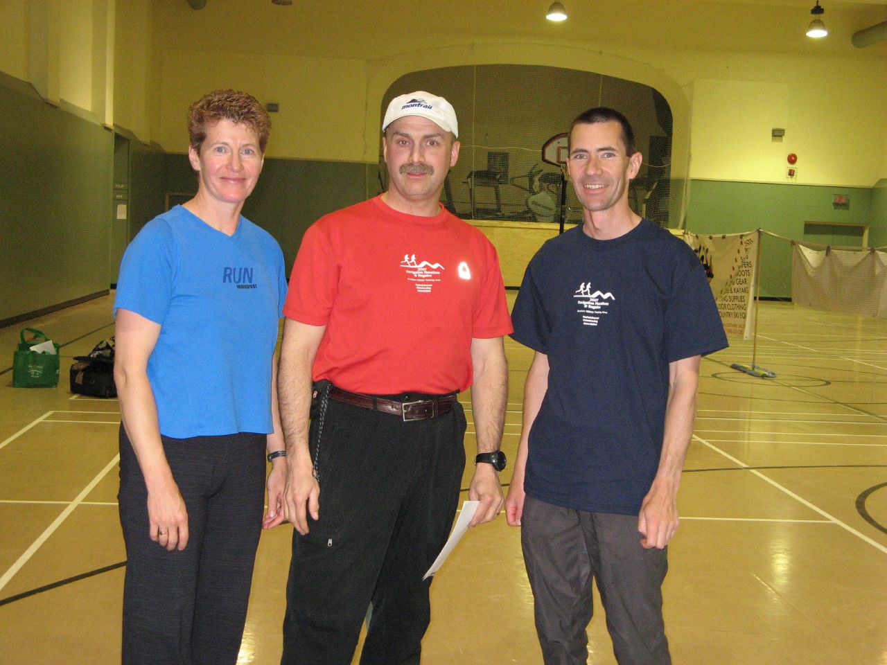
Pictures from Warren Long, one of the participants.

Gear

Packing light is an important factor. A light pack won't make you win, but a heavy pack will certainly ruin your chances. Shelley and I have managed to lighten our packs each year. This year they weighed about 7 kg (about 15.5 lbs). This is pretty good considering you are required to carry rain jacket and pants, tent (not just tarp), sleeping bags, stove, food, and water. 2 liters of water was 2 kg (4.4 lbs) of that weight. Most teams were a lot heavier. One team beat us by a few pounds but sacrificed comfort - a one man tent and no thermarests.

For the gear heads reading this, we used a Black Diamond First Light tent (1.2 kg), North Face Kilo Bag sleeping bags (1 kg), Prolite 3 small Therm-a-Rest's (370 g), Arcteryx Alpha SL Goretex jackets (350 g), and an MSR Pocket Rocket stove with Titan titanium pot and a half size fuel cartridge (300 g total). Shelley used Salomon XA Pro 3D trail running shoes. I used the XCR Goretex version of the same shoes, not so much for being waterproof (conditions were pretty dry) but more to keep out the sand which can be pretty abrasive on your feet. We also used short gaitors to keep junk out of our shoes.

Friday, April 13, 2007